


Using a combination of data from Twitter, Flickr, and remote sensing can help responders identify hotspots in ways that satellite data alone cannot, according to a new analysis of the emergency response to the 2013 flood in Boulder, Colorado.
Response teams typically prioritize rescue and aid efforts with help from imagery and other data that show what regions are affected the most. Responders commonly use satellite imagery, but this on its own has drawbacks.
“Publicly available satellite imagery for a location isn’t always available in a timely manner—sometimes it can take days before it becomes available,” says Elena Sava, graduate student in geography at Penn State. “Our research focused on identifying data in non-traditional data streams that can prove mission critical for specific areas where there might be damage. We wanted to see if social media could help filling the gaps in the satellite data.”
The 2013 Colorado flooding was an unprecedented event. Boulder received more than 43 centimeters (17 inches) of rain in nine days in September—a total equal to annual rainfall during a typical year. Officials evacuated more than 10,000 people and had to rescue several thousand people and pets.
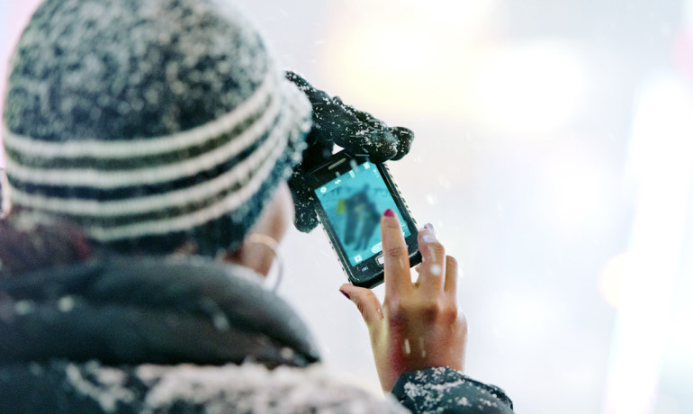
Because the flooding occurred in an urban setting, researchers were able to access more than 150,000 tweets from people affected by the disaster.
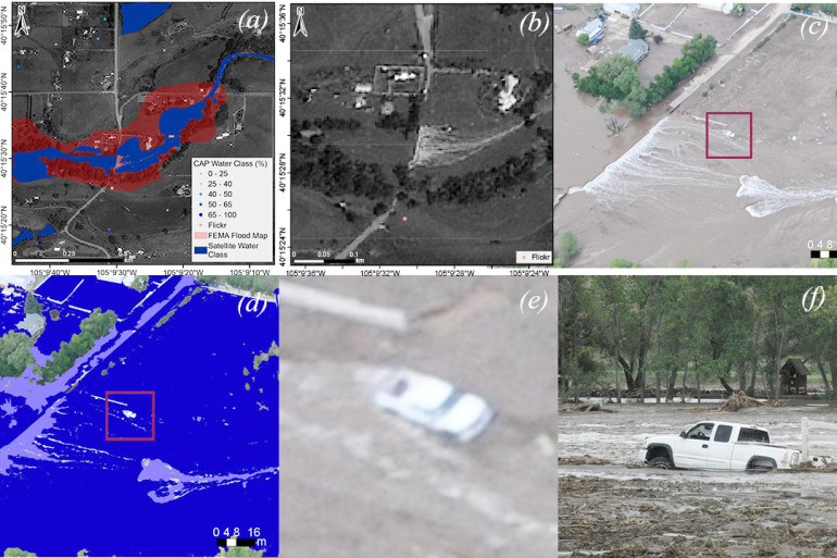
Using a tool called CarbonScanner, they identified clusters of posts suggesting possible locations of damage. Then they analyzed more than 22,000 photos from the area obtained through satellites, Twitter, Flickr, the Civil Air Patrol, unmanned aerial vehicles, and other sources.
“FEMA (the Federal Emergency Management Agency), the Red Cross, and other response agencies use social media now to disseminate relevant information to the general public,” says Guido Cervone, associate professor in Penn State’s Institute for CyberScience. “We have seen here that there is potential to use social media data from community members to help identify hotspots in need of aid, especially when it is paired with remote sensing imagery of the area.”
Responders need information in real time during disasters, so the researchers developed an innovative approach to collect and analyze images from numerous sources in near real time. They developed a machine-learning algorithm to automatically analyze several thousand images, which allowed them to quickly identify individual pixels of images that contained water.
“We looked at a set of images and manually selected areas that we knew had water and areas that had no water,” says Sava. “Then, we fed that information to the algorithm we had developed, and it allowed the computer to ‘learn’ what was and wasn’t water.”
The team’s findings, published in the International Journal of Remote Sensing, confirm that Twitter data could serve to identify hotspots for which satellite imagery should be acquired.
The team also finds that satellite imagery on its own is not always reliable, and that social media can be fused with remote sensing imagery to help identify the extent of the flooding.
“If you look at satellite imagery, downtown Boulder showed very little flooding,” says Cervone. “However, by analyzing Flickr and Twitter data, we could find several cues that many areas were underwater. People would mention a ‘river in the road’ or mention how they can’t get to their house because of the water. Those posts are indicators that we cannot rely on satellite data alone, and we must integrate satellite data with additional data from unmanned aerial vehicles, airplanes, and social media to identify the impacted areas.”
The team is now fine-tuning their algorithms and assessing whether they can be applied to future flooding events. They are also investigating whether other social media platforms, such as Facebook or Instagram, could provide useful data to emergency responders.
Collaborators on this study include researcher from Penn State; the University of Wisconsin, Madison; and the Carbon Project. The team performed their analysis with supercomputers at the National Center for Atmospheric Research in Boulder, Colorado.
The US Department of Transportation and the Office of Naval Research supported this project.
Source: Penn State and Futurity.org


